China
ချိုမိုလန်းမားတောင်ထိပ်ရှိ ဆီးနှင်းထုကို တရုတ်စူးစမ်းလေ့လာရေးအဖွဲ့ တိုင်းတာ
ပေကျင်း၊ ဇူလိုင် ၁၀ ရက် (ဆင်ဟွာ)
တရုတ်စူးစမ်းလေ့လာရေးအဖွဲ့က ချိုမိုလန်းမားတောင်ရှိ ဆီးနှင်းထုကို ရှင်းလင်းတိကျသော ground-penetrating radar ဖြင့် တိုင်းတာခဲ့ပြီး တောင်ထိပ်ရှိ ပျမ်းမျှဆီးနှင်းထုမှာ ၉.၅ မီတာခန့်ရှိကာ အနိမ့်အမြင့် ၁.၂ မီတာခန့် ကွာခြားနိုင်ကြောင်း The Cryosphere ဂျာနယ်တွင် အသစ်ထုတ်ဝေသောစာတမ်းအရ သိရသည်။
ယမန်နှစ် မေလက ချင်းဟိုင်-တိဗက် ကုန်းပြင်မြင့်တွင် တရုတ်နိုင်ငံ၏ ဒုတိယအကြိမ် သိပ္ပံပညာရပ်ဆိုင်ရာ စူးစမ်းလေ့လာမှု၏ တစ်စိတ်တစ်ပိုင်းဖြစ်သော ချိုမိုလန်းမားတောင် လေ့လာမှုအတွင်း အဆိုပါ အချက်အလက်ကို ရရှိခဲ့ခြင်းဖြစ်သည်။
ချိုမိုလန်းမားတောင်ပေါ်ရှိ ဆီးနှင်းထု စူးစမ်းလေ့လာရေးသည် ယခုသိပ္ပံပညာရပ်ဆိုင်ရာ ကြိုးပမ်းအားထုတ်မှု၏ တာဝန်များအနက် တစ်ခုဖြစ်သည်။
စူးစမ်းလေ့လာရေးအဖွဲ့အနေဖြင့် ချိုမိုလန်းမားတောင်ထိပ်ရှိ တွေ့ရှိထားသော မြေလွှာကျောက်သားတစ်လျှောက်နှင့် တဖြည်းဖြည်းတောင်ထိပ်အထိ တိုင်းတာရန် 1000 MHz အလွှာထုတိုင်းတာရေးရေဒါကို အသုံးပြုခဲ့ကြောင်း တရုတ်နိုင်ငံ သိပ္ပံအကယ်ဒမီအောက်ရှိ တိဗက်ကုန်းပြင်မြင့် သုတေသနအင်စတီကျုမှ သုတေသီ Yang Wei က ပြောခဲ့သည်။
ယင်းရေဒါတိုင်းတာမှုများတွင် တောင်၏မြောက်ဘက်ဆင်ခြေလျှောတစ်လျှောက် နှင်းထုအနက်မှာ ဖြည်းဖြည်းချင်းမြင့်တက်သွားသည်ကို ဖော်ပြနေကြောင်း ၎င်းက ဖြည့်စွက်ပြောခဲ့သည်။ (Xinhua)
………………………………
(English Version)
Chinese expedition measures thickness of snow at Mount Qomolangma summit
BEIJING, July 9 (Xinhua) — A Chinese expedition team measured the thickness of snow on Mount Qomolangma with a precise ground-penetrating radar, and the mean depth estimates at the summit are 9.5±1.2 meters, according to a newly-published paper in the journal The Cryosphere.
The data was obtained in May last year during a Mount Qomolangma expedition which formed part of the country’s second comprehensive scientific expedition on the Qinghai-Tibet Plateau. Exploring the snow depth on Mount Qomolangma is among the tasks of this scientific endeavor.
The expedition team used the 1000 MHz thickness-measuring radar to measure along the exposed bedrock at the top of Mount Qomolangma, and gradually to the summit, said Yang Wei, a researcher from the Institute of Tibetan Plateau Research under the Chinese Academy of Sciences.
He added that the radar measurements displayed a gradual increasing transition of snow depth along the north slope.
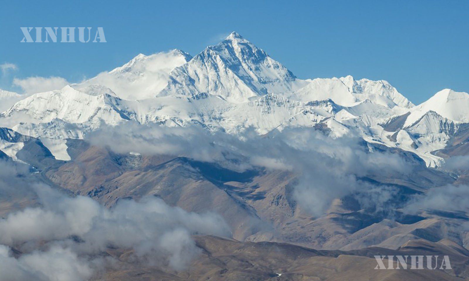
Photo: This aerial photo taken on May 26, 2023 shows a view of Mount Qomolangma seen at an altitude of 6,000 meters in southwest China’s Tibet Autonomous Region. (Xinhua/Sun Fei)